HIKING & BIKING

MACLAREN SUMMIT TRAIL
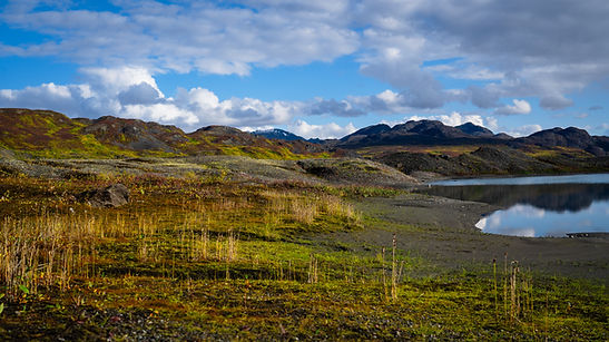
The MacLaren Summit Trail along the Denali Highway (mile 37, about 5 miles east from the lodge) is a spectacular, gentle ridge walk offering sweeping panoramas of the Alaska Range, MacLaren River valley, nearby glaciers, and wild tundra filled with dwarf birch, moss, lichen, berries, and summer wildflowers. Situated at 4,086 ft (Alaska’s second‑highest highway pass), it’s a breeze for hikers, runners, and bikers, and even works well for cross-country trekkers - just stay on marked paths due to its controlled-use status.
The trail is relatively flat, stretching about 9.5 mi in total to Seventeen‑Mile Lake if you venture further, but a casual walk up from the summit spot offers unforgettable views in just minutes. Wildlife likes it too - watch for ptarmigan, pikas, ground squirrels, and fall berry-picking birds.


WILDERNESS CAMP
Second night’s half price, third night’s free - staying longer? We’re happy to work something out!

THE CAMP
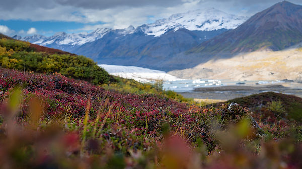
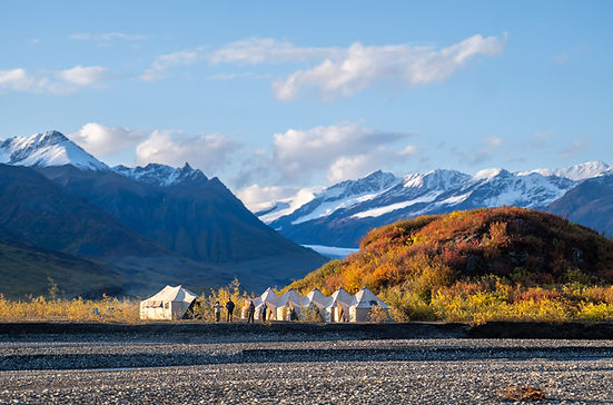
Twelve miles upriver from the lodge, our wilderness camp offers a quiet base in the heart of the backcountry—accessible only by boat. We’ll get you there and back with everything you need!
The camp includes spacious tents that sleep up to three people each, plus a larger community tent for gathering and cooking. Cots, chairs, and tables are provided for your comfort. In the evening, unwind by a bonfire with views of the Maclaren Glacier.
WHAT TO EXPLORE
Wander across the glacier moraine where the camp sits, or climb the nearby hills for views of the valley, waterfalls, and alpine plants. In fall, the hills surrounding the camp are filled with wild berries ready for picking.
The glacier lake is about a 6 mile hike from the camp on a mostly flat, off-trail area.
GETTING BACK
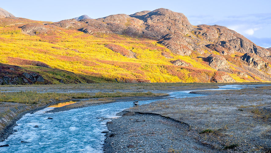
You can return by boat with us or paddle downriver in a canoe. If you choose to canoe, we will drop you off a couple of miles downriver from the camp where the braided sections end. This is a class I float.
For experienced paddlers, the upper stretch from the glacier offers a longer backcountry route with the first mile of the river being up to class III+ rapids depending on season and water levels. Below the main rapids, the river mellows to class I with braids and a lot of shallow areas to navigate. Total distance from the glacier is about 19 river miles.


MACLAREN RIVER
GLACIER LAKE, MAIN RIVER & WEST FORK


Glacier Lake
The glacier lake is located directly below the face of the Maclaren glacier. There are several ways to get there - you can take the trail from Maclaren River Lodge that is about 9 miles long and crosses a couple of creeks. If you are staying at the wilderness camp, you can take a day hike of about 10 miles round trip. Third option is to get dropped off below the rapids by a boat and continue on foot for about 1 to 2 miles, depending on how far you'd like to go.
Main Maclaren River
LAKE - BELOW RAPIS (About 2 mile stretch) - class III (IV during high water)
The upper section of Maclaren river is up to class IV whitewater depending on water levels. This section has large water features and several sections with large boulders.
BELOW RAPIDS - 2 MILES BELOW CAMP (About 7 mile stretch) - class II
This stretch starts below the main rapids and is a class II with some choppy water at the beginning followed by braids with shallow areas to navigate. Water is fast flowing during high water levels and potential debris to navigate.
2 MILES BELOW CAMP - LODGE (About 12 mile stretch) - class I
This is the stretch of the river we offer canoeing on. Easy slow flowing water to navigate.